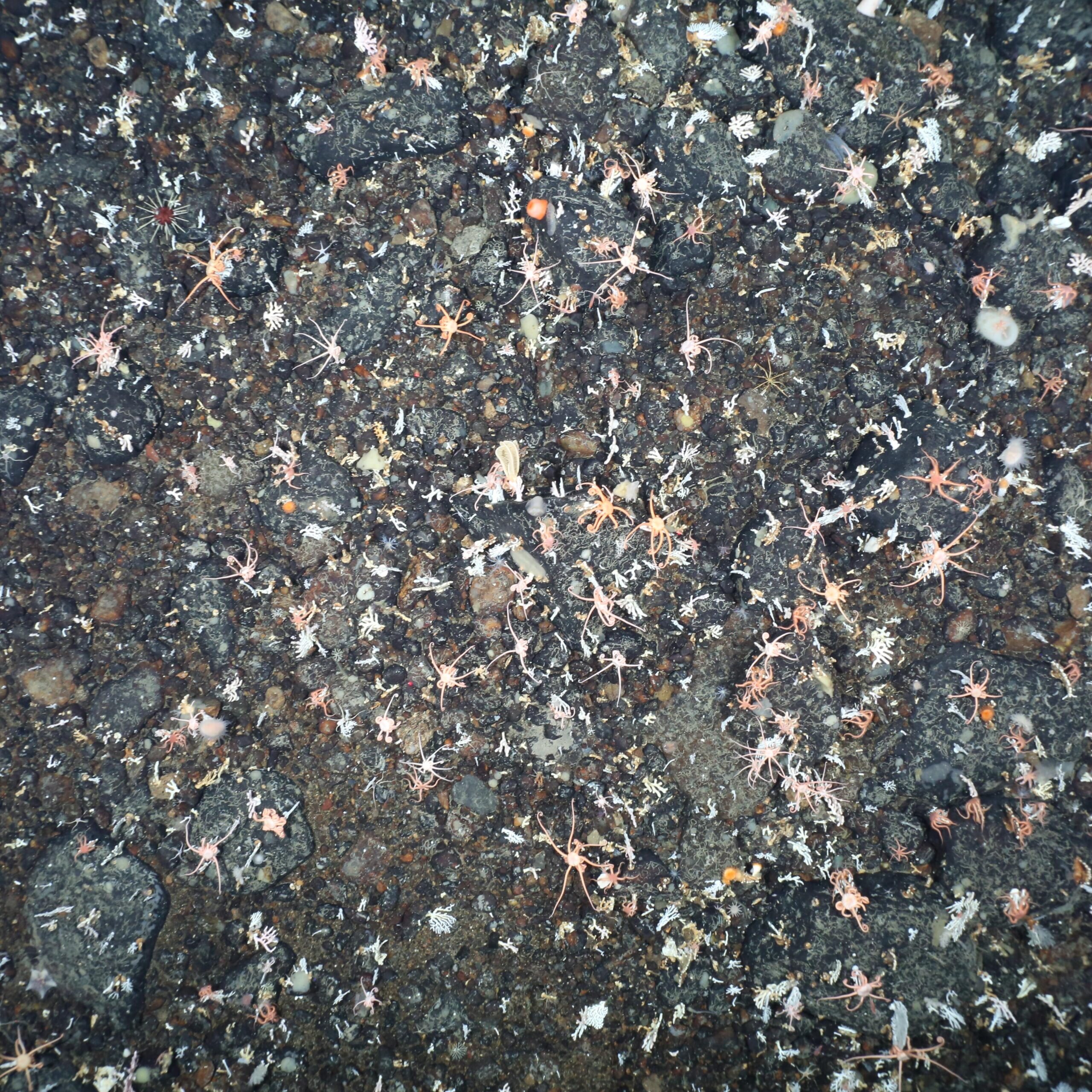
The British Antarctic Survey unveiled an AI model that reduces seafloor image analysis times from six to eight hours per photo to just a few seconds, allowing researchers to make real-time decisions onboard. The system is designed to deliver rapid, accurate biodiversity data critical for designating marine protected areas, particularly in ecosystems highly vulnerable to climate change. By shrinking processing times so dramatically, the tool directly enhances scientific efficiency.
The model was trained on high-resolution imagery from the Weddell Sea collected aboard Germany’s RV Polarstern, starting with 100 expertly labelled photos. It now processes tens of thousands of images and reliably identifies common benthic species such as starfish, corals, sponges and fish. Given that the Antarctic seafloor is home to over 94% of all known Southern Ocean species, improved speed translates into immediate conservation value.
Researchers are currently analysing more than 30,000 images from the Antarctic Peninsula and the Weddell Sea, a scale that could yield descriptions of new species and inform targeted policy action. Cutting analysis from hours to seconds enables expanded survey coverage and broader use of non-destructive, image-based biodiversity monitoring.
Sources:
1.
2.
3.